
Blizzard Conditions Possible Tonight
12/25/23 330PM: Forecast update from the National Weather Service.
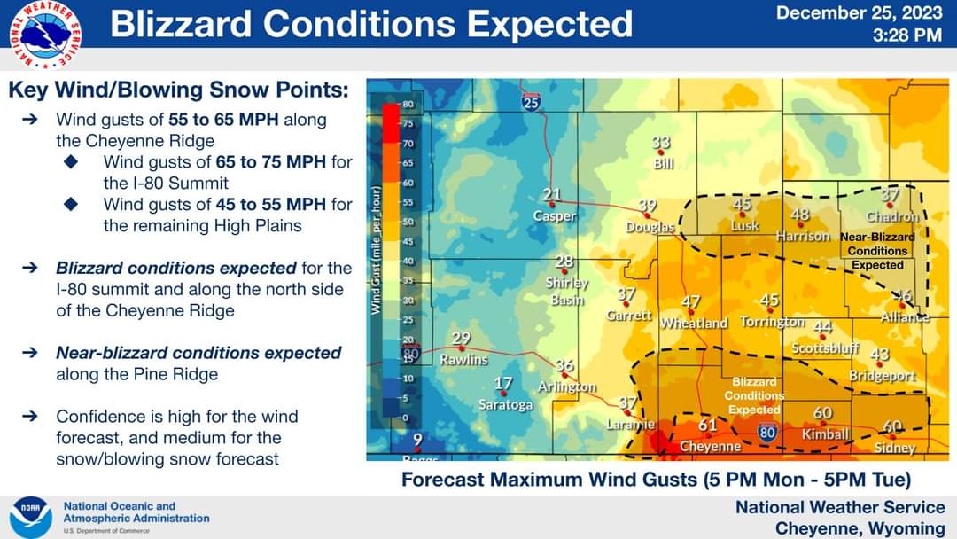
Another round of winter weather will arrive beginning later this evening, and continue its impacts through early Wednesday. This snow will be arriving from EAST towards the WEST. A slowly moving surface low pressure will retrograde from the Central Plains towards our forecast area, bringing a prolonged window of snowfall and gusty winds to the area. Several different winter and wind headlines are in effect, so careful attention to where you live makes a difference here. Near-blizzard to blizzard conditions are expected, with visibility impacts from blowing snow expected.
Please look at the images included with this post as it will assist you with FAQ. Check weather.gov/cys and weather.gov/cys/winter for additional information for areas that you reside in, or plan on traveling to over the holiday.


